


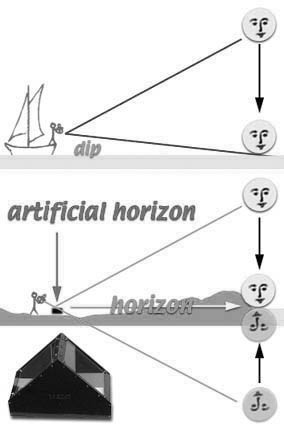
 This example is from a sight I did at the Louisville Airport on March 31st 2014 using an artificial horizon. If you live inland and it’s inconvenient to go to a coast where you can do a sight, you can do sights anywhere using an artificial horizon. It is a method which has been around for centuries. Lewis and Clark used an artificial horizon to navigate through the newly acquired Louisiana Purchase in 1804. You can make your own with a pie pan of water. Or you can buy one from one of the resources in the links. They are inexpensive and the manufactured ones have a little roof on them for filters or plain glass to keep the wind off the surface. When you do your sight, bring the two sun images in contact as shown in the diagram. The LL correction is used if the bottom of the sun is in contact with the top of the reflection in the pan of water. The angle you get is then divided in half. There is no dip correction when you use the artificial horizon.
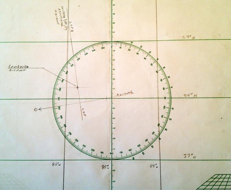
Now on to the example. The location of the airport, according to my iPhone, was 38° 11’ N, 85° 44’ W. I set up a plotting sheet with those coordinates, using 38° N and 85° W as the centers of the sheet.
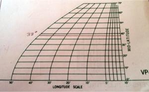
Longitude ScaleA minute of longitude is only equal to a nautical mile at the equator. To get the proper longitude scale anywhere else, go to the right-hand graph and draw a line through your assumed latitude, as shown in the picture, and use that to mark out your longitude lines, and later, your assumed longitude.
The azimuth circle in the center of the plotting sheet makes a very convenient source for your bearings, but it also helps in locating the longitude lines. At 38° latitude, notice that the longitude 84° W passes right through the 38° on the outer edge of the circle.
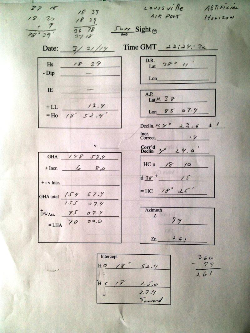
The form has all the information for the day and time of the sight, 3/31/14 at 22:24:32 GMT. If you have a smart phone, you can get the exact time of your sight by looking at the clock in your phone. I do a screen shot of a GMT website on my phone at the moment of my sight.
Otherwise, get a cheap quartz clock or watch to carry around with you and set it to Greenwich Time.
The rest of the form is self-explanatory and follows the procedures described above. You can see my extra scribbles at the top to divide the artificial horizon HS in half, and also in the bottom right where I converted Z to Zn by subtracting Z from 360. My sight was in the afternoon so the sun would have to have a bearing of greater than 180 degrees.
It’s good practice to do sights from different places so that you have new numbers to crunch. If you are always doing sights from the same place it can get a little boring.
To do this practice example, you will need the almanac and reduction tables. The sight is real and you can check your numbers against mine as you go through the process. Just print out the LOP form and get started.
 On the plotting sheet the heavy cross is my true location at the airport. I have labeled the azimuth line to show the direction of the sun. The convention is to use a circle with a dot in it to indicate the sun. The LOP is at right angles to it.
You can see that this was a pretty good sight, accurate to less than a mile.